News
Spring Groundwater Levels Stable
July 1, 2025
Groundwater Levels Stable
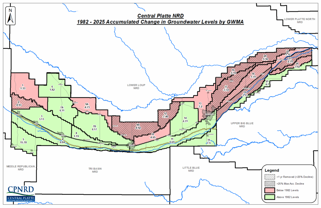
Luke Zakrzewski, GIS Image Analyst, reported at the June Board of Directors meeting that the spring 2025 static groundwater levels showed a loss of only -0.80 feet District-wide compared to the levels in 1982.
The 1982 levels were established as the baseline for the NRD’s Groundwater Management Plan, which includes maximum acceptable declines and a margin of safety calculated for each of the Groundwater Management Areas (GWAs). Since 1982, changes in the NRD’s 26 Groundwater Management Areas (GMAs) range from an increase of 15.78 feet in GMA 5 (Frontier and Buffalo counties), to a decrease of -9.92 feet in GMA 9B (Buffalo County).
CPNRD staff reads over 400 wells each spring to monitor groundwater levels. For the 2025 assessment, 416 wells were measured, which Zakrzewski said equates to one well per 2,500 irrigated acres.
-
Main Office
- 215 Kaufman Ave, Grand Island, NE 68803 308-385-6282
-
Cozad Office
- 75887 Road 414, Cozad, NE 69130 308-380-8943
-
NRCS Field Offices (Ext. 3)
- Central City 308-946-3035
- Kearney 308-237-3118
- Grand Island 308-395-8586
- Lexington 308-324-6314
- Osceola 402-747-2461
-
Quick Links
© 2025 Central Platte Natural Resources District