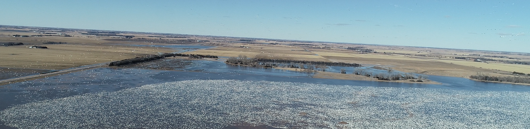
Flood Reduction
Central Platte NRD works with landowners and other agencies to minimize damages that cause flooding. CPNRD is comprised of 30 municipalities with varying flood control issues and challenges. The NRD has invested in flood reduction projects across the NRD ranging from dams, levees, diversion channels and detention cells.
UPDATE: The Elm–Turkey Creek Watershed Plan feasibility study is nearly complete. The public comment period has closed and comments have been addressed. The CPNRD Board will consider adoption of the plan at its January meeting. Adoption does not commit the District to future phases but allows the NRD to pursue funding. Following adoption, the Board may consider advancing to the Design Phase, depending on NRCS funding availability. Projects of this size typically take several years to complete based on funding, planning, and partnerships.
The Elm and Turkey Creeks watershed planning area includes more than 106,000 acres in Dawson and Buffalo counties and the southern limits of the City of Kearney. Planning began in October 2020 at the request of communities, residents, and property owners impacted by the 2019 flooding. The study evaluated existing flood conditions, reviewed flood-risk-reduction alternatives, and developed a flood risk reduction plan. FACT SHEET
For details visit: https://www.floodsafe-cpnrd.org/
Flood Risk Reduction Projects
The physical characteristics of floodplains influence flood behavior and provide important flood-loss-reduction benefits, including the following:
Excess Water Storage
Except in narrow, steep valleys and areas with coastal bluffs, floodplains provide broad areas where floodwaters can spread out and be temporarily stored. This storage reduces flood peaks and flow velocities, lowering the potential for erosion and damage. Floodplain storage is particularly important in urban areas, where even relatively small events—such as 5- or 10-year storms—can cause significant flooding. One acre of floodplain inundated to a depth of one foot can store approximately 330,000 gallons of water.
Flow Rate and Erosion Reduction
In their natural, vegetated state, floodplains slow the rate at which overland flow reaches rivers and streams. Vegetation also stabilizes soils and reduces shoreline erosion. In coastal environments, features such as beaches, sandbars, dunes, and wetlands serve as natural buffers that dissipate wave energy and help protect inland areas from flooding and erosion.
Runoff Reduction and Infiltration
Natural floodplains promote surface ponding and flood detention, while subsurface soils support infiltration and temporary storage. Slowing runoff across the floodplain allows more time for water to infiltrate and recharge groundwater aquifers when storage capacity is available. This process also provides natural water-quality benefits, as runoff and floodwaters are filtered while percolating through floodplain soils and alluvial deposits.
Flow Regulation During Non-Flood Periods
During non-flood conditions, groundwater discharge helps regulate river flows and maintain water levels in lakes and ponds. During periods of abundant water, excess surface water can enter the groundwater system instead of contributing to flood peaks. Conversely, during dry periods, groundwater flows back into surface waters, reducing the frequency and duration of extremely low-flow conditions.
Amick Acres Project
Buffalo Creek Watershed-Structures
Cairo Downtown Improvement Project
City of Gibbon
Clarks Floodplain
Clear Creek Watershed
Dams Inventory and Rehab
Doniphan Drainage
Elm Creek/Turkey Creek Watershed
Ice Jams
Kearney Northeast Flood Control Project
Kearney West Clearing Project
Kirkpatrick Memorial Park Lake
Lake Helen
Lepin Ditch Flood Control Project
Moores Creek Flood Control Project
Odessa Area Flood Control Project
Platte County Project
Prairie Creek Clearing Project
Prairie-Silver Flood Control Project
Silver Creek Watershed
Warm Slough/Trouble Creek Flood Control Project
Wood River Watershed
Wood River Flood Control Project
The Amick Acres Project Improvement Area is located in south central Hall County, just to the west of Doniphan. It diverts flood and drainage water away from the Amick Acres residential subdivision by utilizing part of a county road ditch for approximately 1 mile. The initial cost was $25,000; most assessed to benefiting landowners. Maintenance is done as necessary at an estimated cost of $500-$1,000 annually. Actual costs are calculated and assessed to benefiting landowners.
Feasibility planning for flood control was completed in the Buffalo Creek Watershed, located in Custer, Dawson and Buffalo counties. CPNRD received approval for cost-share funding from the Natural Resources Development Fund to construct seven flood control structures in the watershed: B-1, B-3, C-5, F-l, F-3, F-5 and F-7. Additional work: B-1: the largest structure, was completed in 1983 along with the supply canal, 1.6 miles of power line relocation and 1/2 mile of county road improvement. In addition to flood control, the project was expanded to include recreation and groundwater recharge. Cracks were identified in the B-1 structure in the fall of 1983. Repair included installing a chimney drain system on the back side of the structure and was completed in 1985. In 1987, the reservoir was opened for day fishing. In 1995, a petition from numerous landowners requested that the NRD discontinue filling the reservoir because they were concerned that the reservoir contributed to high water tables in the c Hydrological studies conducted by the NRD showed that the B-1 reservoir made no significant contribution to the high water tables and that projected groundwater declines had not materialized due to continued strong annual rainfall amounts. However, the request to stop filling the reservoir was granted effective January 1, 1996. In May 2009, the board voted to start filling the B-1 Reservoir in Lexington every other year starting in spring of 2010 and was required to fill the reservoir once every five years to keep the NRD’s water right. In March 2011, the board approved leasing water from B-1, for a one-year basis, to 40-45 individuals who needed 1-15 AF of water. In March 2013, the board voted to start filling the reservoir every year and to get it back to its original concept. The NRD has a diversion right of 4,000 acre/feet of water per year from NPPD to fill the reservoir and there are plans to have the NGPC begin stocking the reservoir within this planning period. F-7: Cracks were identified in the structure and repair was completed in 1990 at a cost of $11,500. Two sites in the Buffalo Creek Watershed north of Lexington were studied to determine their potential as flood control structures. Based on the study, the NRD board determined that construction of flood control structures at those sites was not feasible and that all further planning efforts for the watershed would be discontinued. Operation & maintenance continues for all of the structures in the watershed including dam safety checks. In addition, CPNRD will fill the reservoir periodically with the minimum amount of water to satisfy the project’s Platte River water right.
In 2007, the NRD provided $50,000 to the community of Cairo to add a 48” drainage outlet for the Project to divert excess water along the Hwy 11 corridor. The previous drainage system couldn’t handle a one-year rainfall event, which caused overflow ponds and flooding in low areas. The community of Cairo contributed $2 million to the project.
The City of Gibbon filed a formal request for help with a drainage project. Olsson Associates proposed solutions to the city’s current drainage system including relocating the existing sluice gate, improvements on hydraulic conditions at the outfall and installing an automated sluice gate system. The total cost of the project is estimated at $150,000 and has been added to the Hazardous Mitigation Plan to be considered for Federal funding in the future. In 2008, provided $50,000 to the City for improvements to the stormwater system and the project was completed in 2010. In April 2015, OA reviewed what the City of Gibbon had accomplished towards drainage issues and the additional needs in order to resolve remaining issues. CPNRD staff has facilitated meetings with the City of Gibbon, Buffalo County, and CPNRD to address the remaining drainage problems.
Silver Creek is the major source of flooding in the area. The board approved participation in the Clarks Floodplain mapping study up to $5,000; which is 50% of the expected cost of the study and needed to meet FEMA requirements. The study and funding were added to the 2014 Fiscal Budget.
Clear Creek Watershed in Polk County encompasses 75,700 acres & has a long history of flooding. A feasibility report for flood prevention and watershed protection was completed in 1978; which lead to the construction of 15 flood control structures completed in the watershed. Funds from the Natural Resources Development Fund were received on 5 of the larger structures. Polk County provided funds to construct additional smaller structures including road structures.
In 2016, JEO received $39,500 to conduct an inventory of the 40 dams nearing their 50-year lifespan. It included dams that are one acre or larger. JEO’s $25,000 fee was requested through the Hazard Mitigation Plan.
2019: Conceptual design was developed by evaluating 150 existing and potential dam and other structure sites. The design determined: localized water balance, recharge potential, storage capacity, design and conceptual cost for dam improvement or new construction. JEO received $140,680 including $56,270 in Water Sustainability Funds and $84,410 from CPNRD.
2021: Design improvements and dam safety permits were completed. The long-term plan is to replace, update or remove aging structures.
Dam Improvements
2023: JEO received $14,000 for additional services required for the rebidding and construction phase of the Jones and Clear Creek dams. Completed projects:
- Box Elder 5A/Buffalo County: channel improvements downstream, dredging around the drawdown, riprap
along the dam face. Kokes Construction advised staff that crushed rock surfacing wasn’t needed for the access road. Existing drawdown plate and valve were removed, 18" slide gate in riser was installed bringing the cost of the project to $136,555. Project was completed in 2022. - Clear Creek 5/Polk County: replaced the drawdown with structural elements, riprap along dam face, repair of slough in auxiliary spillway, leveling of a low portion of the top of dam. Cost increase of $7,613.45 was due to adjustments for pressure-treated dimensional lumber stop logs & stainless-steel guide rails and additional rock riprap on the face of the dams. Kokes Construction was awarded the bid in the amount of $76,970. The project (near Duncan) was completed in 2023.
- Jones 1A/Polk County: replaced riser and spillway pipe. Kokes Construction was awarded the bid for dam rehabilitation in the amount of $145,593. Project (near Osceola) was completed in 2023.
July 2023: The Board approved a change order in the amount of $7,613.45 from JEO Consulting Group for dam repairs on Clear Creek and Jones Creek reservoirs in Polk County. The change order includes a cost increase due to adjustments for pressure-treated dimensional lumber stop logs and stainless-steel guide rails on Clear Creek; and additional rock riprap on the face of the dams. Photos
June 2025: Clear Creek Dam 6 The Board approved Amendment #1 for $4,000 from JEO Consulting to establish easement documentation & conduct the bidding process to rehabilitate the dam in Polk County, seven miles south of Columbus, NE. Repairs will include:
- Raising the dam crest because it had settled below the design elevation
- Rebuilding the wave berm
- Filling in erosion/rut at interface of dam and auxiliary spillway
- Filling in erosion/ruts on the auxiliary spillway backslope in two main spots
- General re-grading of the downstream exit portion of the auxiliary spillway
- Adding a small berm on downstream portion of auxiliary spillway to contain flows
- Fencing around the dam and auxiliary spillway
- Reseeding disturbed areas
In 2015, the Village of Doniphan requested $4,000 to pump standing water from a detention cell located in the city park and into the curb and gutter system. The project was completed in the fall of 2015.
A feasibility study was conducted for $125,000 and submitted to the Nebraska Resources Development Fund to request cost share. A community meeting was held in June 2006, on the feasibility study for Elm Creek Watershed Flood Control Project. 130 landowners attended. Olsson Associates’ Plan consisted of a 975-acre flood control and re-regulating reservoir located northwest of the Village of Elm Creek and two dry flood control structures located on Turkey Creek. The reservoir would provide both traditional flood reduction benefits to the Village of Elm Creek and non-traditional environmental benefits including recreation. The Turkey Creek structures would reduce current peak flows to downstream areas. Together, the flood control structures would provide flood protection to the Village of Elm Creek and downstream cropland. The preliminary cost estimate was $22.8 million. The board approved a study with OA to perform a geotechnical investigation and seepage analysis of the area. The study involved the drilling 30 test borings at the reservoir site and adjacent lands to determine if leaching would raise adjacent water tables to a level that would create problems for either cropland or basements. OA developed a preliminary design feasibility study and CPNRD applied for Resources Development Funds. In June 2012, the board again reviewed the project due to a potential new source of funding from the Nebraska Water Cash Fund. The board authorized staff to work with OA, Nebraska Public Power District (NPPD), State of Nebraska & Platte River Program on options to move forward with a project. The proposed project was estimated at 6,800 -12,000 AF depending upon future agreements with a projected cost of at least $35 million. In 2013, the board approved the transfer of funds in the amount of $631,465 that was originally designated for the proposed Elm Creek Re-Regulating Reservoir to the CNPPID’s new J-2 Reregulating Reservoir project; cutting the Elm Creek project from the budget.
In July 2011, the board approved an inter-jurisdictional cooperative agreement on how to deal with ice jams in the Middle Platte River, with the formation of a continual escrow (interest-bearing) account in the amount of $50,000. If an ice jam were to begin, CPNRD would be the first entity to start the process of calling FEMA & NEMA; in which the entire process could be completed in one day. The agreement is signed by seven partners who have deposited $37,000 in an emergency fund to use in the case of an ice jam on the Platte River. In 2016, the board voted to dissolve the existing Platte River Ice Jam Removal Agreement. Instead, the agreement partners plan to develop a working agreement that will focus on emergency preparedness in the event of an ice jam related to flooding and safety education. All funds in the ice jam account were returned to the partners who include: Tri-Basin NRD and Buffalo, Hamilton, Merrick, Phelps, and Kearney counties.
A cooperative effort involving the City of Kearney, Buffalo County, and CPNRD, was initiated in 1990 due to the expansion to the northeast of the city of Kearney. The expansion has resulted in increased flooding on an unnamed tributary of the Wood River resulting mainly from storm runoff. CPNRD obtained aerial photography and participated in survey work needed for topographic mapping of the affected area. After the mapping was completed in 1991, NRCS conducted a feasibility study to determine what options were available. In 1995, Miller & Associates developed a plan for the watershed; including channel improvements, drop structures, road crossings and a detention cell. Cosponsors shared costs of the project & agreed to do the construction in phases so taxpayers would not have a large one-time impact. To stop a serious erosion problem at the point where water had been entering the Wood River, a drop structure was constructed in 1996 at the cost of $240,000 by the NRD. As part of its bridge replacement program, the County also built a road structure used by the project. The project was completed in three phases: Phase I: The existing channel was widened starting at the drop structure and meandered westerly and south to a point near 56th Street on Eaton Road. Phase III: (Completed before Phase II) In 2000, properties were bought and construction was completed on the detention cells and channel improvements. Detention cells are located 1/2 mile north of “N” Ave and 56th St in Kearney. Construction included 300,000 yards of excavation with a 50 ac/ft storage design for a 100-year storm and a 50 ac/ft storage design for a 25-year storm on the other cell. In 2003, the NRD approved a contract change to complete channel improvements south of the detention cells and to control erosion. There were 800,000 cubic yards of soil excavated to create the channel. Storage capacity is 200-300 ac/ft. Phase II: Consisted primarily of channel improvements from the Phase I channel south to about 39th Street and then westward to Antelope Road. Phase II to Phase III, from 56th Street to Avenue N was completed in the spring of 2006. The total cost of the project was $3.4 million.
In the fall of 1999, landowners west of Kearney requested a clearing project to assist them with flooding problems along Turkey Creek, also known as the Platte River North Channel. About 2 1/2 miles were cleared after the request. In 2000, an additional mile was cleared and snagged. Snagging & clearing was done in 2000 on the North channel and again in 2001 at a cost of $8,650. In 2002, the NRD was notified that the North Channel of the Platte River/Turkey Creek had eroded to within 5 feet of a local sandpit. The U.S. Corps of Engineers surveyed the problem and provided an Emergency 404 permit to the NRD to stabilize the bank. The City of Kearney provided 25% of the total cost (approximately $1,850) and the NRD provided $13,500.
In October 2016, the board approved a $25,000 request from JEO towards lake improvements for the Kirkpatrick Memorial Park Lake in Lexington, NE. Improvements include 4,000 cubic yards of dredging, 2,500’ of bank improvements including removal of trees, and a 700’ seawall to the four-acre lake. The project will provide improvements to water quality, aquatic habitat, public access and provide an area for educational events. Construction is expected to be completed in the fall of 2017.
In 2013 & 2014, CPNRD provided $75,000 towards the restoration of Lake Helen in Gothenburg for water quality conditions. The lake was drained to accommodate: excavation of 171,773 cubic yards of sediment, stabilization of 3,391 linear feet of shoreline, development of underwater shoals, installation of a circulation system, dam repair, installation of a pier and boat ramp. Sediment and nutrient loading from outside the lake boundary was addressed by treating the lake with aluminum sulfate to precipitate phosphorus, installing a deeper well to access lower phosphorus water, and stocking recreational fish. The total cost of the water quality and habitat project was nearly $1.8 million. The project was completed in 2016.
Landowners petitioned CPNRD in 1993 to solve excess storm runoff that was overloading the “old north channel” of the Platte River north of I-80 in southwest Hall County. A study by Nebraska Department of Roads (NDOR) & CPNRD determined that the problem resulted when I-80 was constructed and an attempt was made to redirect runoff from the Lepin Ditch to another crossing site under the Interstate. This joint project was developed to place a culvert in the vicinity of the natural channel to allow runoff to flow under the Interstate at $700,000 with partners CPNRD, NDOR and Hall County. Easements were obtained from area land-owners for construction and maintenance of the ditch. The county provided site preparation and ditch excavation and provides maintenance. CPNRD contributed $120,000; which was completed in 1995. NDOR provided funds for the culvert.
In the 1980s, CPNRD, and others recognized the need for flood control in Hall & Merrick counties on Moores Creek. Project sponsors- CPNRD, City of Grand Island, Merrick & Hall counties– submitted the feasibility study to the Nebraska Natural Resources Commission in January 1984. The Commission approved the Moores Creek Project and agreed to cost share at a 65% rate. A three-phase construction plan was developed and carried out. Phase I: Channel improvements from the mouth near Archer upstream to the Hall-Merrick county line were completed in 1990. Phase II: Three detention/retention and wildlife habitat enhancement cells were completed on Moores Creek channel from the Hall-Merrick county line upstream to Grand Island. Phase III: Waterways and bridges were constructed to enable storm runoff from the Capital Heights area, northwest of Grand Island, to drain into the improved Moores Creek channel. Project was completed in 1995. Annual maintenance is completed as needed with an approximate cost of $20,000.The U.S. Army Corps of Engineers participated in studies in the early stages of the Project. Following new rules for such projects adopted in the 1980s, the Corps reviewed its findings and conducted reconnaissance studies to determine if a project was possible after the criteria changed. The review indicated highly feasible floodway projects using several different routes. Following public hearings in 1989, the Corps narrowed the choices and began a study to determine the actual feasibility of a route to carry excess water from the Wood River and Warm Slough into the Platte River. Appropriation and construction-start authorizations were obtained from Congress in 1996. The Corps’ revision of plans and increased projected cost required new Congressional re-authorization, accomplished in 1999. Construction began in March of 2000. In 2002, the Corps contract was increased by $1 million due to miscalculations regarding the amount of topsoil needed for the project. 180,000 yards of soil was added with co-sponsors paying $95,000 of the increase.
A total of 500 acres were involved in land acquisition for the project; 2 miles west of Hwy 281 to the Hwy 34 bridge along the Platte River where 5 bridges were constructed. A reappraisal of Hall County Park resulted in an agreement/compensation for damages to the RV park with the Hall County Board. The board proceeded with the remaining 11 tracks of land needed for the project. Benefits of the project include flood control for flood zones in the Grand Island, rural Hall and Merrick counties and groundwater quality improvement. Close to 7,000 acres of land were taken out of the flood zones. FEMA revised its floodplain maps in 2004, taking away the need for flood insurance in southern Grand Island. Landowners had been paying $317,000 to protect $56 million worth of property prior to the revision of the floodplain maps. Full funding of the Federal share enabled construction to be completed on schedule. CPNRD borrowed funds in the amount of $1.1M at an interest rate of 6.5%, to meet the needs of project construction over a 2-3 year period. All monies were reimbursed to CPNRD by the State of Nebraska through a cost-share grant and the other local sponsors. The entire project was completed and dedicated in May 2004. Total cost was about $15 million as follows: $7,148,000- U.S. Army Corps of Engineers, $4M– Nebraska Department of Natural Resources, $1.4M- CPNRD, $1.2M-City of Grand Island, $352,000- Hall County, $200,000-Merrick County. CPNRD is responsible for maintenance, with costs split between the cosponsors. In 2015, $25,000 was approved for JEO to complete design work for the Wood River Flood Control Project’s System-Wide Improvement Framework. The board also approved $20,000 for maintenance and repairs required by the Corps of Engineers.
Miller & Associates of Kearney started the final design of the Odessa Area FCP in 2008 and completed it in 2010 at a cost of $15,000. The Project is located east and south of the project boundaries include the Odessa Road to the west, 24 Road to the North, and Sartoria Road to the east. The 2-mile project consists of improvements to existing roadside and field drainage ditches, replacement of culverts and supplementing existing culverts.
The Platte County Project is an improvement area located just southwest of Duncan. The project provides drainage improvement and minor flood control benefits to 1,300 acres of irrigated cropland in southwest Platte County. Maintenance is performed as necessary at an estimated cost of $500-$1,000 annually. Actual costs are calculated and assessed to benefiting landowners.
Flooding from Prairie Creek caused considerable damage to agricultural property in the past. While the Prairie-Silver Creek Flood Control Project had a local effect, it didn’t solve all of the flooding problems on Prairie Creek, nor did it evolve that a feasible project could be developed to solve all of the flooding problems on the stream. Further study indicated that damages could be reduced by keeping the channel clear. Snagging and clearing projects involving the selective removal of timber, trash, and debris from the stream channel in an area of 35 feet on either side of the center of the channel were completed from the mouth of Prairie Creek in Merrick County to the Hall-Buffalo county line. Annual maintenance is approximately $10,500.
A flooding problem was studied by the NRD in central Hall County, just west of the city of Grand Island. CPNRD determined that the problem was caused by two short stretches of Prairie Creek and Silver Creek that produced channel overflow after large storm events. A project was developed to correct the problem by cleaning out the channels and constructing training levees to prevent the Construction was completed on the project in 1986. Construction and land leveling in the area disturbed natural drainage flows along the Prairie/Silver Creek, northwest of Grand Island. In 2000, a design proposed by the NRCS was approved by the board to install a uniform drain and add culverts for a two-mile stretch. The total cost was $22,000 of which the NRD provided $17,500.
Located in Merrick County, this watershed encompasses approximately 90,000 acres. A feasibility study was completed in 1979 to provide flood relief in the watershed with the project completed in four parts that consisted of mainly channel improvement. Phase 1A: Lower 4.1 miles of Silver Creek. 1B: One mile of Silver Creek and 15 miles of the Clarks drain. Phase 2: Continued upstream on Silver Creek for 6 miles. Phase 3: The next 10 miles upstream. Phase 4: Wasn’t completed until the fall of 1987 due to wet weather in the 1985 & 1986 construction seasons. The 11-mile stretch upstream from Hwy 14 north of Central City to Silver Creek’s headwaters west of Chapman. The Board approved the extension of the project at a cost of $7,500 in February 2000 due to additional flooding. Maintenance costs are approximately $20,000 annually.
Due to a history of flood damage to agricultural and urban property within Central City, a project was proposed for reducing flooding along those streams; caused by storm runoff into the Warm Slough, Dry Run, and Trouble creeks. That project would have included construction near Grand Island in order to take care of storm runoff from the city, as well as channel clearing and renovation from Grand Island to Central City. A study determined that portions of the project were not economically feasible. A revision was made that subsequently dropped the infeasible portions of the plans. Partial funding was provided by the state through the NE Natural Resources Development Fund. Cosponsors, with varying shares of the local matching portion, were CPNRD, Merrick and Hall counties, and cities of Grand Island and Central City. Construction was completed in 1993 and maintenance responsibilities were turned over to Merrick County and Central City. In 2002, the NRD performed snagging and clearing of the Lower Warm Slough from Grand Island to Central City with an initial cost of $110,000. Additional funds in the amount of $23,000 were transferred to complete the project since the construction company was required to truck the dirt away due to the close proximity of wetlands in the area. From June 1-8, 2008, Central City received over 6” of rainfall, which exceeded a 100-year event. The project has improved drainage of the entire watershed.
In 1972, snagging and clearing was completed from the mouth of the stream to Gibbon in 1972. In 2002, one mile was cleared at a cost of $20,000. Annual maintenance for the Wood River Clearing Project is about $10,000. Additional spot clearing is completed as needed.
The Wood River has 173 miles of channel meandering through the Platte River Valley with numerous flood control structure sites in its upper reaches. During the June 1967 flood on the Wood River, most of the rain fell east of Kearney where there were few flood control structures sites. 10’ of rain fell over 9 days from June 7-15, with 3.2” falling on June 13. Extensive damage was done in Grand Island. Following new rules for projects adopted in 1980s, the U.S. Corps of Engineers conducted reconnaissance studies and found highly feasible floodway projects using several different routes. Following public hearings in 1989, the Corps began a study to determine the actual feasibility of a route to carry excess water from the Wood River & Warm Slough into the Platte River. Appropriation/construction to start authorizations were obtained from Congress in 1996. The Corps’ revision of plans and increased project costs required new Congressional reauthorization in 1999. Construction began in March 2000. In 2002, the contract was increased by $1M due to miscalculations regarding the amount of topsoil needed with 180,000 yds of soil added with co-sponsors paying $95,000 of the increase. 500 acres were involved in land acquisition for the project; 2 miles west of Hwy 281 to Hwy 34 bridge. Reappraisal of Hall County’s RV Park resulted in compensation for damages to the Hall County Board. The board proceeded with the remaining 11 tracks of land needed for the project. In 2005, a total of 7.21” of rain fell between May 11-12, more than any one-day of rainfall during the 1967 Flood. The 300’-wide channel provided flood protection for 1,500 homes/businesses. On June 1-8, the project was tested again with 6” of rain. Benefits of include flood control for Grand Island, rural Hall/ Merrick counties, & groundwater quality improvement. CPNRD borrowed $1.1M for construction over 3 years. CPNRD was reimbursed by the State of Nebraska through a cost-share grant and local sponsors. The entire project was completed and dedicated in May 2004.
-
Main Office
- 215 Kaufman Ave, Grand Island, NE 68803 308-385-6282
-
Cozad Office
- 75887 Road 414, Cozad, NE 69130 308-380-8943
-
NRCS Field Offices (Ext. 3)
- Central City 308-946-3035
- Kearney 308-237-3118
- Grand Island 308-395-8586
- Lexington 308-324-6314
- Osceola 402-747-2111