Prescribed Fire Program
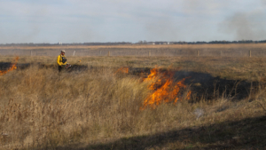
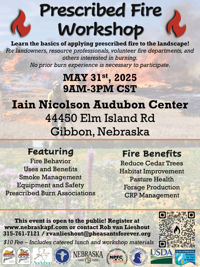
PRESCRIBED FIRE WORKSHOPS
Basic burn workshops are scheduled from January to May throughout the state & online to provide a solid foundation on the fundamentals of planning and conducting a prescribed fire. No prior experience is needed.
$10 fee includes training materials and a meal. To register, visit NebraskaPF.com/RxFireWorkshops
PRESCRIBED BURN COST
Rate Structure
The minimum charge for all burns 40 acres or less is $2,000. Burns more than 40 acres will be charged $2,000 with additional charges per acre over 40 acres.
· Burns 41 - 159 acres: $2,000 + $16/acre over 40 acres
· Burns 160 - 319 acres are $2,000 + $8/acre over 40 acres
· Burns over 320 acres will be determined on a case-by-case basis
Cost Share Availability
The 50% cost share eligibility was extended to include landowners who are not enrolled in another program or contract.
CPNRD staff will continue to develop burn plans, assist with the prescribed burns, and assist with grants to aid Prescribed Burn Associations.
Central Platte’s Prescribed Fire Program was initiated to promote and encourage landowners to form Prescribed Burn Associations. The NRD has conducted and assisted with 306 prescribed burns totaling 51,832 acres since 2004. Most of the prescribed burns for landowners vary from 20 acres up to 160 acres.
Although CPNRD has met goals to educate landowners on the safe and effective use of prescribed fire for land management, the new rate structure was necessary since the subsidized rate was less than Prescribed Burn Associations needed to charge to cover their expenses and the subsidized rate was competing with private industries. CPNRD’s rate set in 2004 was also outdated and did not cover the NRD’s expenses.
To learn more about the Prescribed Burn Program and how it may help your land reduce invasive Eastern Red Cedar or improve your pasture for grazing call (308) 385-6282.
Your CPNRD Contacts Bill Hiatt: hiatt@cpnrd.org & Nelson Winkel: winkel@cpnrd.org
BROCHURE
Prescribed fire is a very valuable practice for Nebraska’s rangelands and prairies. Farmers in Central Platte NRD are having great success using fire to improve their pastures. It does entail some risk, which is why safety training and proper equipment are necessary. The NRD has had an important role in helping departments and landowners obtain safety training. Rangeland areas that have not had fire occurrence are often sites of problems involving invasive species. The invasive species, such as Eastern Red Cedar, can take away natural grassland acres that are necessary for grazing as well as for wildlife. Rangelands that are always grazed in the fall or winter with no spring treatment may also become areas dominated by native and non-native cool-season grasses and invasive weeds. These areas offer a reduced food value to livestock and are of reduced value to native wildlife.
The NRD has conducted/assisted with 306 prescribed burns totaling 51,832 acres since 2004. Most of the prescribed burns for landowners vary from around 20 acres up to 160 acres. When a prescribed fire is used along with appropriate grazing practices, the results are increased economic output and wildlife benefit. Fields that are moderately grazed and treated with periodic burns are more drought-tolerant, more diverse in plant and wildlife species, more productive in late summer, at less risk for devastating summer wildfire, and at less risk for runoff and erosion. See an example of a prescribed fire on the CPNRD Prairie/Silver/Moores Flood Control Project: https://youtu.be/XyZFuCBlFyM
- Control undesirable vegetation
- Prepare sites for harvesting, planting or seeding
- Control plant disease
- Reduce wildfire hazards
- Improve wildlife habitat
- Improve plant production quantity and/or plant quality
- Remove slash and debris
- Enhance seed and seedling production
- Facilitate distribution of grazing and browsing animals
- Restore and maintain ecological sites
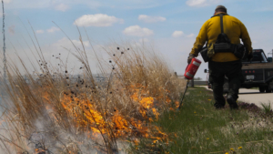
- Must be planned by a person(s) qualified to carry out such work.
- Must be reviewed and approved by CPNRD’s Burn Coordinator before the prescribed burn can be accomplished.
- Landowner(s) required to obtain a valid open burning permit as per Nebraska Statute 81-520.01.
- Must be carried out by a qualified team or private company approved by the NRD Burn Coordinator.
- Proof of adequate insurance & landowner liability agreement will be required before any action may be conducted under this program.
- CPNRD accepts no liability for any prescribed burn activity associated with the application, application approval, prescribed burn approval, or the prescribed burn itself.
There are three steps involved in the successful use of prescribed fire:
Planning
An open burning permit and prescribed fire plan must be completed prior to each burn as mandated by state law. The NRD fire coordinator will be available to assure the fire plan meets all state law requirements.
Preparation
Burn unit boundaries and internal features need to be prepared prior to the burn to help ensure safety. The NRD prescribed fire coordinator will assist in making recommendations for this type of preparation. Preparation can include mowing or disking the lines or anchor points, and brush or tree removal/piling. Reduced and deferred grazing may be necessary to produce best burning conditions.
Implementation
The burn must be implemented by the NRD crew or a qualified and insured prescribed fire contractor.
New Rate Structure
The minimum charge for all burns 40 acres or less is $2,000. Burns more than 40 acres will be charged $2,000 with additional charges per acre over 40 acres.
· Burns 41 - 159 acres: $2,000 + $16/acre over 40 acres
· Burns 160 - 319 acres are $2,000 + $8/acre over 40 acres
· Burns over 320 acres will be determined on a case-by-case basis
50% cost share eligibility includes landowners not enrolled in another program or contract. CPNRD staff will continue to develop burn plans, assist with prescribed burns and assist with grants to aid Prescribed Burn Associations.
Additional Financial Assistance
Healthy rangelands and abundant wildlife habitat are essential for cattle and wildlife in our state. Central Platte NRD offers unique programs to producers to maintain range and habitat. Because fire is the most economical tool for removing unwanted trees, the following programs focus on assisting producers in implementing prescribed fire in their operation:
Grazing Deferment Program
Reimburses landowners for part of the cost of laying land idle to prepare for a successful burn.
Application
Burn Preparation Cost-Share
Reimburses landowners for part of the cost of tree work to prepare pastures for a burn.
Application
For more information contact on the Prescribed Fire Program contact Bill Hiatt at 308-395-7365 or hiatt@cpnrd.org
For cost share information contact Kelly Cole 308-395-7134 or for more information email Kelly cole@cpnrd.org
PSM Main Cell North Burn Unit: 11/15/2021
Prepared by: Bill Hiatt, CPNRD hiatt@cpnrd.org 308-385-6282
Why We Burned the Cell
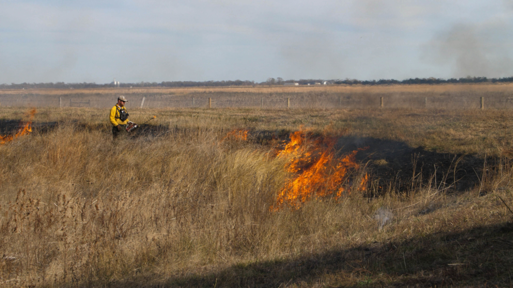
Planning for the Upper Prairie/Silver/Moores Flood Reduction Project prescribed burn started in the fall of 2018. The original plan was to burn this unit the following spring, however, the cell held water for nearly 14 months following the March 2019 flood. Seasonal rains and snow melt put water back into the cell in 2020 extending the delay.
Ideally, it’s best to burn in the spring to catch cattails at their beginning stages of growth to eliminate cattail coverage in the cell. But with wet springs and heavy snow melt in 2019, 2020, and 2021, an introductory burn in the fall was the best option. Cattails are a concern because they tend to form monocultures in wet areas, pushing or shading out most other plants that would otherwise be present. In ecological terms, a monoculture is the growth of a single species over a large area, leaving the area much less resilient and resulting in the loss of many or all species of wildlife. Monocultures are not limited to only wet areas but can occur in any land type and are caused by a variety of species of vegetation, but especially invasive or encroaching species, such as Eastern Redcedar trees in rangelands.
The cattails also posed a barrier to effectively manage Phragmites that moved into the cell following the 2019 flood. Trails were mowed through to the Phragmites patches to spray herbicide and the Platte River Recovery Implementation Program contractor sprayed from the air, but both options are costly and time consuming. Eliminating the extra work to get to the Phragmites through cattail management is much more efficient.
The NRD’s goal for land management in the cells is to provide diverse habitat while the cells are dry. While the neighboring Cornhusker Wildlife Management Area is open to hunting, we DO NOT provide public access. Wildlife can be viewed from any of the county roads around the property. The cells are currently used mostly for cover and as travel corridors for visiting waterfowl and wildlife; however the NRD's goal with increased plant diversity is to provide higher quality forage. There are resident populations of deer pheasants, Bobwhite quail, a variety of small birds and mammals, raccoons, opossums, coyotes, and even a pair of nesting Bald Eagles. Migrating waterfowl, Great blue herons, and a variety of birds of prey also visit the site regularly.
Planning and Preparation
In June 2021, a Burn Plan was written specifically for this unit to determine where, when, why, and how the burn would be conducted. Every plan is written to give guidance to the crew and the Burn Boss (as it may be different from the person who planned the burn). It also identifies the specific weather conditions that the fire will be lit under, which is referred to as the Prescription. This covers a range of temperatures, relative humidity, wind speed, and directions that must be followed to conduct a safe and legal burn. In addition to writing the plan, maps were also made to layout the unit visually (see map). The map legend identifies other valuable information for the burn crew. These maps are handed out during the briefing before the fire and carried throughout the burn for reference. Extra effort is put into planning and preparing the burn to ensure there are no injuries to people or damage to property. As part of the plan, objectives for the burn are set forth. The objectives for this burn were:
1. Remove dead, standing cattails and phragmites
2. Encourage wetland plant diversity
3. Control of woody species
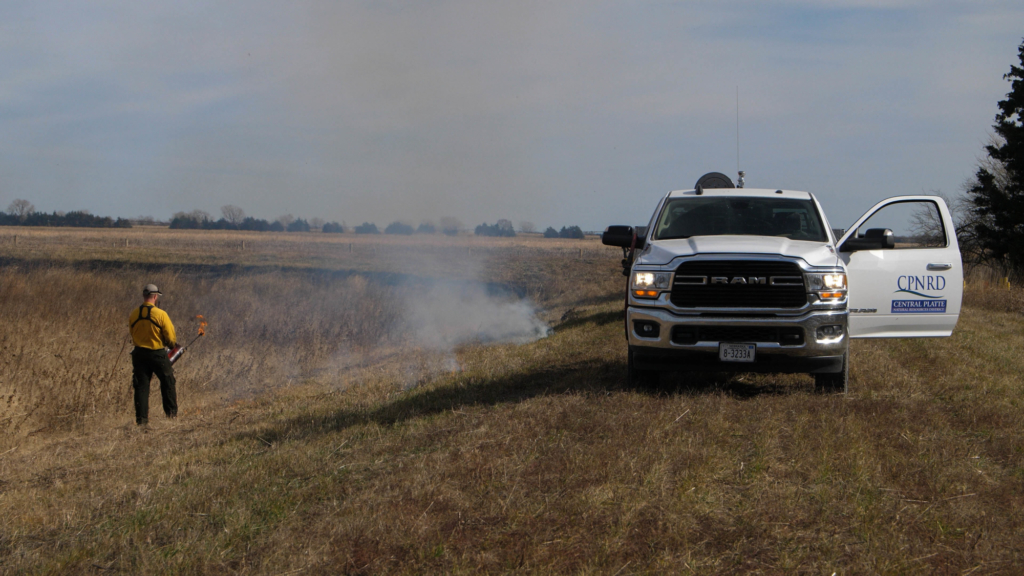 For this burn, mow-lines were located on the berms surrounding the cell in late summer and re-mowed vegetation when it went dormant in the fall. A mow line was installed across the cell bottom on the south side of the burn to separate the fire from the southern portion of the main cell. Mow-lines, in conjunction with wet-lining, are used to reduce fire behavior to allow us to control the spread of fire more easily at the edges of our burn unit and wood removed to make the burn much safer and easier to mop-up. These lines vary in width depending on the surrounding fuels and expected fire behavior. These lines are still considered a part of the unit and are simply so it can easily be put out. Many times, it is helpful to allow part of the mow line to burn, so the line is even more substantial.
Another parameter was to wait to burn until after the surrounding crop fields were harvested to lessen the chance of inflicting economic damage and provide areas for the fire to extinguish if it crawled beyond the boundary. When the last surrounding field was harvested on 11/5, weather monitoring began to find a “burning window” that would fall within our Prescription.
Active fire behavior was expected due to the volatility and amount of wetland vegetation in the cell. Wetland vegetation is typically more volatile due to a higher presence of natural oils than in other vegetation, like native grasses. Wetlands also tend to be more productive than other areas due to an abundance of water and nutrients available to the plant community leading to higher fuel loads.
On 11/8, an email was sent to many partner organizations to ask for their assistance. Since the week of 11/7 to 11/13 was too to burn, fire lines were shored up, resources were gathered and inspected, and potential assistance was located for the burn. The weather forecast was checked multiple times per day including communication by phone with NWS Hastings staff about what they expected.
By 11/11, Monday (11/15) was looking like a good day to conduct the burn. Those planning to assist were contacted and staff started to stage equipment near the burn unit. On 11/12, CPNRD staff picked up five 1,000-gallon water trailers from Aurora Co-Op in Grand Island and stationed them at the NRD office as a quick source of water on the burn line. Since night temperatures dropped to a low in the 20s, tanks were filled on Sunday (11/14) to prevent any freezing damage to the pumps and lines. Staff filled and hauled tanks to the designated sites around the burn unit. The crew was also notified to meet at 10:30 a.m. the next day for the burn.
Implementation
The morning of 11/15 was a busy one. Various pieces of equipment were taken to the unit. En route, the Cairo VFD Chief Steve Oseka was called to get a burn permit. State law requires burn permits to be issued by the local fire chief or their designated people.
At 11:00 the briefing was started, which consisted of going over the plan, assigning crew members to teams, answering questions, and giving an observed and expected weather report, and a weather reading was taken using a Kestrel 3000 Weather Meter.
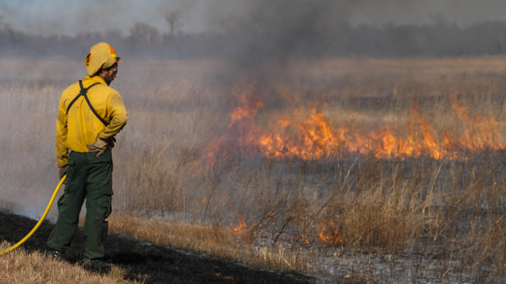
The burn was started in the southeast corner of the unit (downwind corner), due to the wind coming from the northwest. For this fire, we used the standard ring method where the teams traveled in opposite directions (North Team going north, South Team going east) along the berms to meet later in the northwest corner of the unit. The patrol units then traveled between the teams, ensuring that the fire stays within the unit.
A “test fire” was lit on the downwind corner of the unit to observe how the fire would behave and a chance to cancel the burn while it is still small. After the test fire, both teams moved along their respective routes to “build black” by allowing the fire to back against the wind, removing the fuel as we proceed to provide a wider break for later in the fire when fire behavior will be much more intense.
This is also the most time-consuming part of the fire, as it moves very slowly. To speed the process up, small strips are lit inside the unit. These strips are head fires, so important to slowly build up the width to not overwhelm the mow lines and holding units. The South Team held back to allow the North Team to light the east berm so both teams could proceed to the west at the same pace. Once the North Team reached the outlet structure, they sent one engine around to the north berm, leaving the other to watch as the interior lighters built up black. After about 20 minutes, enough black had been built, so the entire North Team relocated to the north berm and proceeded west. The South Team also began traveling west. For the remainder of the fire, the crew were in constant contact with each other over radios, so neither team was out of position.
Around 2:30 p.m. both teams had progressed past the halfway point of the unit, so three flares were fired into the middle of the unit to burnout the fuel to limit the length of line that the patrol units had to cover. At this point, the TNC engine began to experience problems with their pump. With the fire pulling away from the North line and that team having no holding problems, the CPNRD Ford engine was staged on the west side of the creek bed to take over holding from the CPNRD Dodge engine when that team reached the creek.
The wind began to die down which created a problem. The forecast had called for winds beginning out of the northwest, then moving to the southwest at 9 mph. With no wind pushing back, the fire developed its own wind, known as convective driven wind. This occurs with all fire and typically comes in from the back side of the fire and in this case the fuel load and fire behavior were enough that the fire began to move independently to the southwest across the unit. To stay ahead of the fire, the South Team began to pick up their pace. They had already pre-treated some of the trees along that line, so they were able to move faster. The crew of the TNC engine helped this along by lighting strips behind the lead team, as their engine was out of commission. The CPNRD Dodge engine handed off the line to the CPNRD Ford at the creek bed. This team also began to move quickly across the bottom of the cell toward the southwest corner of the unit. As they were moving, patrol units helped hold the line.
Once the line was secure, lighting strips were used to pull toward the convective driven fire, stopping it well short of the line itself. The CPNRD Ford traveled north along the west berm, while the CPRA engine steadily traveled west along the north berm. The fire at this time was quite hot and active, so the North Team moved slower to allow the other engine to stay ahead of their fire. At approximately 4:34 pm, the unit was closed or “rung,” and all the units began to patrol portions of the line to ensure no breakouts. After the edges were stabilized and safe, the crew gathered back at the southeast corner of the unit to debrief, allowing the crew to report what they saw during the burn, what went wrong or right, how to correct problems and ask questions. This also allows the Burn Boss to provide feedback to the crew and lay out the plan for mop-up.
Mop-up is an extremely important part of any burn and should be done to a point that the unit can be left unattended overnight. There are times when it is appropriate to leave people on a fire overnight, such as if there is too much smoldering material to be put out in a brief time. Doing this would also allow the materials to completely burn. If mop-up is not completed, smoldering materials can continue to burn for days or weeks after the fire if they are insulated enough. This is especially dangerous if the wind becomes stronger in the following days. On this unit, the berms needed to be “cold and black” meaning that all burning material is put out or moved farther into the unit, so the edges have no heat source anywhere near them. While the entirety of the line was checked, there were two main areas of concern: the southeast corner and the tree line along the creek bed on the south line. We extinguished all the heat we could find, and the remaining crew left the fire at approximately 7:00 p.m. Equipment was moved to the staging area and gates were locked to arrive back at the office around 8:00 p.m.
Following the Burn
The following day (11/16) staff spent the day checking the entire line looking for “smokers”. The forecast for that day was high in the 70s, winds out of the southwest at 10 to 15 mph, and a low relative humidity in the mid-40s. We did find a few smokers, but overall, the fire was very secure. Efforts were focused on the two problem areas identified the night before. We frequently do an additional day of mop-up after fires and ensure that everything is out before we leave.
On 11/17, with the fire being completely extinguished, water trailers were returned to Aurora Cooperative and equipment taken back to the shop. Overall, every objective was accomplished for the burn. While we did have some problems and unexpected fire behavior, the crew did an excellent job of adapting to these and completing the burn safely. In addition to the burn, parts of the cell will be seeded over the winter to increase the propagation pressure on the cattails. We will follow up this post with another next growing season on how the vegetation community has changed. In the long-term, we will continue to use fire and other vegetation management techniques to develop the diverse wildlife habitat on this property. Upcoming, we are planning to burn the Middle and South piles this coming spring.
Partners on this burn: Aurora Co-Op, Central Platte Rangeland Alliance, Central Nebraska Public Power and Irrigation District, The Crane Trust, The Nature Conservancy, and Pheasants Forever.
For background on why and how prescribed fire is done in general, you can visit our website at cpnrd.org, pick up a copy of our booklet: Prescribed Fire Operations in Nebraska, or talk to one of the many land management professionals or Prescribed Burn Association members that use prescribed fire in our area. There are also many opportunities to attend formal trainings offered by a variety of organizations throughout the State. For information on upcoming CPNRD trainings please check our newsletter, In Perspective, or our website.
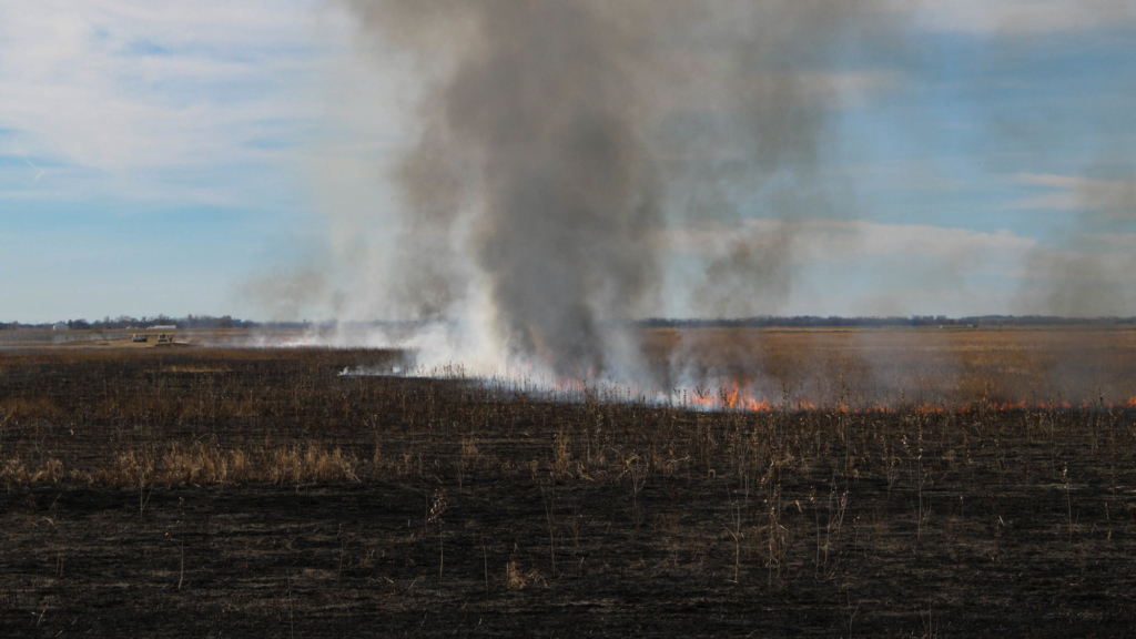
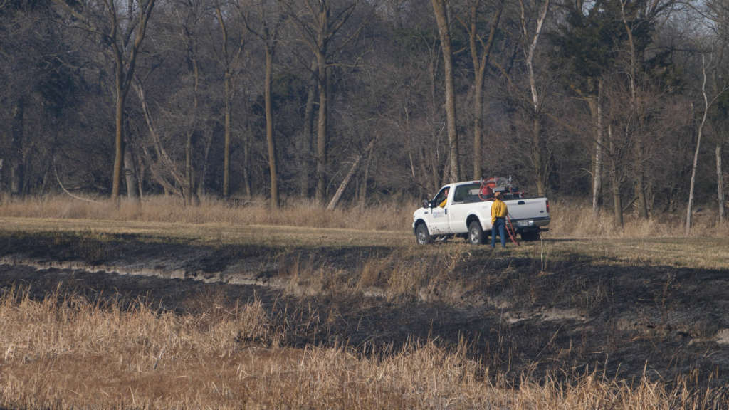
Grazing Deferment Applications Due January 31st
Applications are being accepted for the Central Platte Natural Resources District’s Grazing Deferment Cost-Share Program. Grazing deferment is essential when planning for a prescribed burn. Allowing the site to rest provides the adequate fuel load that is necessary for a successful burn. Most burns rely on fine fuel made up of warm season grasses for combustion to create the desired impacts; which is why it’s important to allow ‘dead grasses’ to remain in the field to serve as the fine fuel for your prescribed fire.
Central Platte NRD's cost-share payment is $30/acre with a maximum of $30,000 per landowner per year. The Grazing Deferment Program was implemented to provide an incentive for landowners to defer grazing in a pasture for one growing season so that a prescribed burn can be successfully applied in the following year to help in cedar reduction.
Priority is given to lands that will be concurrently enrolled in EQIP or WHIP programs through the NRCS or within a CPNRD focus project area for cedar reduction. A field visit and documentation that the land was deferred from grazing from March 1st through the end of the calendar year in the year prior to burn must be provided before the cost-share payment is made. To learn more about deferred grazing or to sign up for cost-share, call the Central Platte NRD at (308) 385-6282 or email Kelly Cole cole@cpnrd.org
Spring 2025 Prescribed Burn RFP
The Rainwater Basin Joint Venture (RWBJV) is a public/private partnership that was established in 1992 to maximize
conservation impacts through leveraging resources to improve wetland and grassland habitat in Central Nebraska. Nebraska Community Foundation (NCF) serves as the financial agent for the RWBJV Partnership. As part of the mission, NCF for Business of RWBJV (NCF fbo RWBJV) is seeking proposals for prescribed fire implementation during the spring of 2025.
Bid Instructions:
- Submit bids by 6:00 pm CST January 6, 2024. Mailed and emailed bids must be received by January 6, 2025. Bids
may be submitted via email to winkel@cpnrd.org or mailed to Central Platte Natural Resource District 215 Kaufman
Ave, Grand Island NE 68803
Follow Proposal Guidelines
Proposal content and guidelines can be found within the RFP linked below.
Burn plans can be found here: https://fws-fileshare.app.box.com/s/k7hxsrpfxr4tzr1kfyolrc7v1jrp14vl
Additional Information
Nebraska Game and Parks Areas to Burn
-
Main Office
- 215 Kaufman Ave, Grand Island, NE 68803 308-385-6282
-
Cozad Office
- 75887 Road 414, Cozad, NE 69130 308-380-8943
-
NRCS Field Offices (Ext. 3)
- Central City 308-946-3035
- Kearney 308-237-3118
- Grand Island 308-395-8586
- Lexington 308-324-6314
- Osceola 402-747-2461


